
// Expertise
Energy & Infrastructure
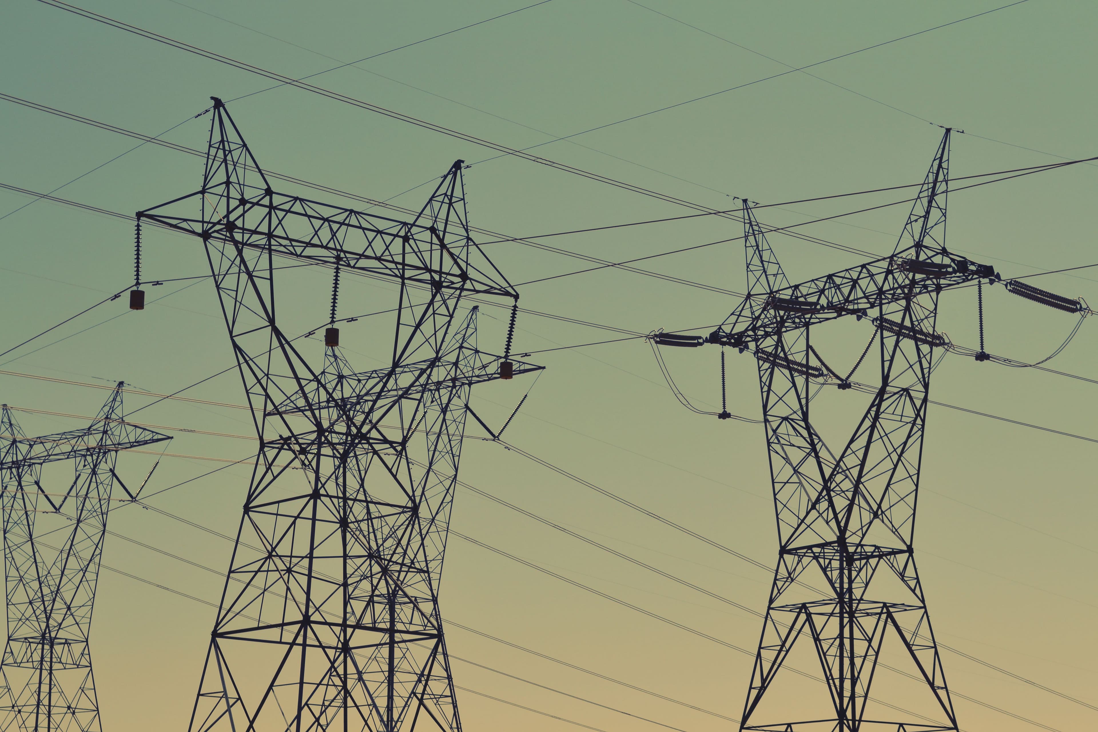
Planning baselines, as-built documentation and monitoring & analysis for power corridors & pipelines as well as road & rail
// Services
Planning baseline
Sound foundations for sustainable decisions.
Asset capture
Up-to-date geospatial data for planning, analysis and documentation.
Monitoring & analysis
Geodata-based monitoring and analysis for efficient infrastructure management.
Project coordination
Efficient project management for successful geospatial projects.
// Planning baseline
A sound basis
As a basis for planning, route alignment and design of infrastructure projects such as roads, railways and energy and utility networks, GSense delivers high-accuracy, georeferenced data products from digital aerial imagery and LiDAR survey flights. Using modern sensor systems, GNSS/INS-based positioning and powerful processing software we produce, among other things, orthorectified image data, classified point clouds and digital terrain and surface models. Specialized survey aircraft and helicopters allow large project areas to be captured efficiently and comprehensively while meeting demanding accuracy requirements.
3D corridor mapping
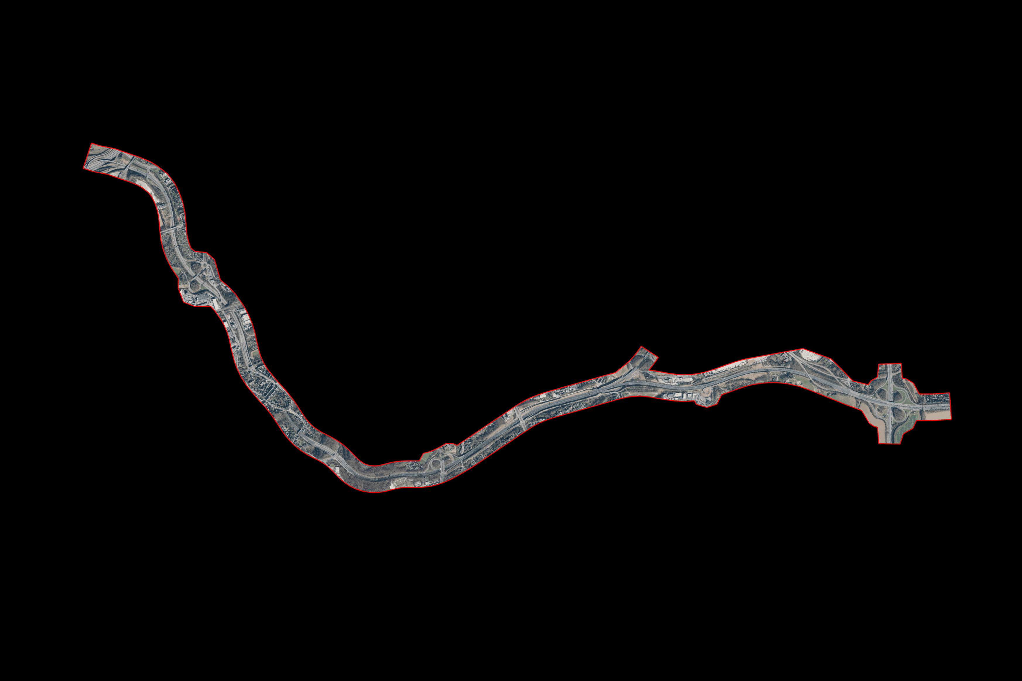
3D corridor mapping enables the efficient capture of high-resolution geospatial data along project corridors. Modern nadir and oblique cameras together with LiDAR sensors deliver precise, true-to-life data. The results integrate seamlessly into CAD, BIM and GIS systems.
Orthophoto / True orthophoto
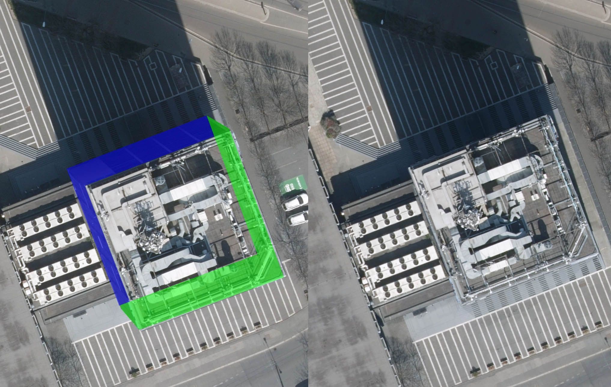
GSense produces high-resolution, georeferenced aerial imagery for planning and decision-making. Alongside precise orthophotos, true orthophotos offer a distortion-free view without occlusions. For route alignment, design and variant studies.
Classified point cloud
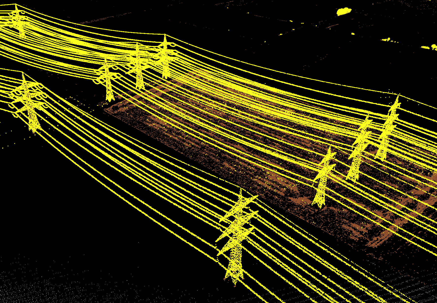
Classified LiDAR point clouds provide a detailed 3D representation of the project area. Every point carries precise spatial coordinates and additional attributes. Classification captures terrain, vegetation, buildings and traffic areas unambiguously and makes them available for targeted analysis.
Digital terrain model (DTM)
Digital terrain models represent the terrain surface as precise elevation information. Based on LiDAR or photogrammetrically captured 3D data, they provide a reliable basis for planning, route alignment and simulation, and integrate seamlessly into digital workflows.
// Planning baseline
A sound basis
As a basis for planning, route alignment and design of infrastructure projects such as roads, railways and energy and utility networks, GSense delivers high-accuracy, georeferenced data products from digital aerial imagery and LiDAR survey flights. Using modern sensor systems, GNSS/INS-based positioning and powerful processing software we produce, among other things, orthorectified image data, classified point clouds and digital terrain and surface models. Specialized survey aircraft and helicopters allow large project areas to be captured efficiently and comprehensively while meeting demanding accuracy requirements.
3D corridor mapping
3D corridor mapping enables the efficient capture of high-resolution geospatial data along project corridors. Modern nadir and oblique cameras together with LiDAR sensors deliver precise, true-to-life data. The results integrate seamlessly into CAD, BIM and GIS systems.
Orthophoto / True orthophoto
GSense produces high-resolution, georeferenced aerial imagery for planning and decision-making. Alongside precise orthophotos, true orthophotos offer a distortion-free view without occlusions. For route alignment, design and variant studies.
Classified point cloud
Classified LiDAR point clouds provide a detailed 3D representation of the project area. Every point carries precise spatial coordinates and additional attributes. Classification captures terrain, vegetation, buildings and traffic areas unambiguously and makes them available for targeted analysis.
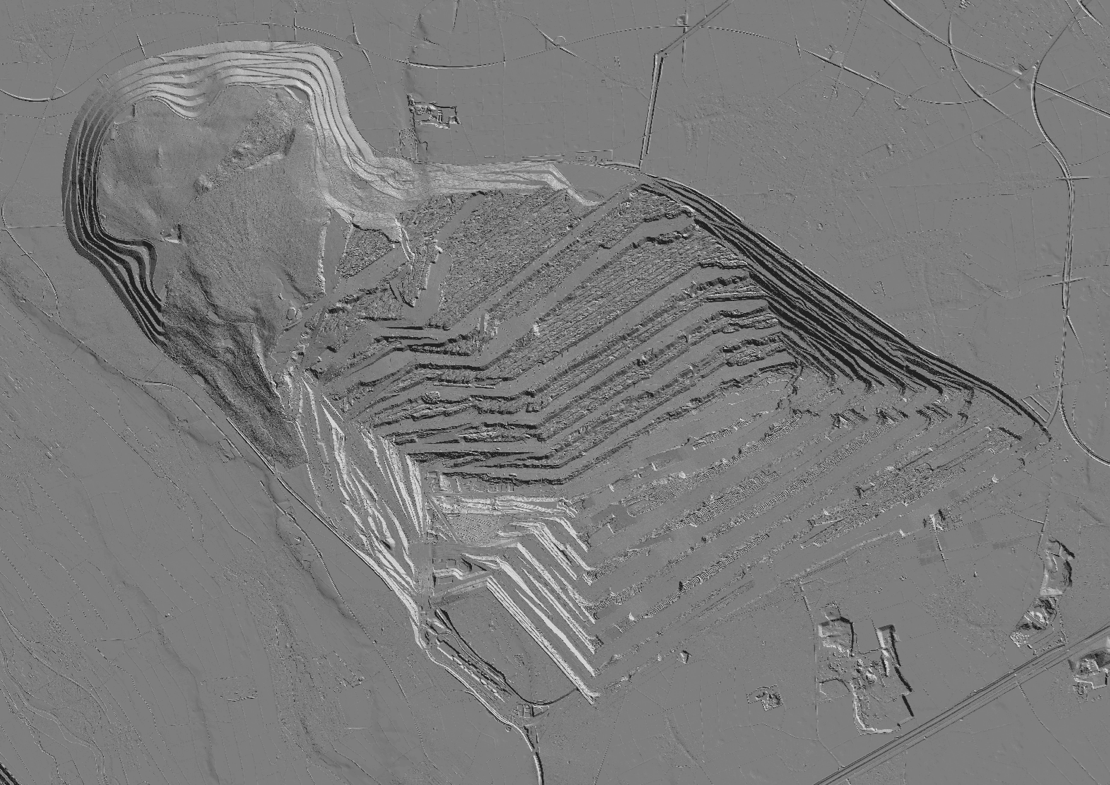
Digital terrain model (DTM)
Digital terrain models represent the terrain surface as precise elevation information. Based on LiDAR or photogrammetrically captured 3D data, they provide a reliable basis for planning, route alignment and simulation, and integrate seamlessly into digital workflows.
// Asset capture
Detailed as-built survey
As-built surveying creates transparency about the condition and surroundings of infrastructure and utility assets. Using digital aerial survey and airborne laser scanning (ALS) we capture power corridors, railway lines, pipelines and road corridors quickly, precisely and comprehensively. The high-accuracy 3D data forms the basis for planning, inspection, operation, maintenance and the construction of digital models. For high-accuracy results GSense relies on state-of-the-art sensors combined with specialized survey aircraft and helicopters. Through precise capture and complete documentation we create the basis for well-founded decisions and safeguard both sustainable operation and the long-term viability of the asset.
Georeferenced oblique imagery
Georeferenced oblique imagery delivers high-resolution views of infrastructure from multiple perspectives. Thanks to precise GNSS and IMU positioning it enables detailed condition assessments, reduces on-site inspections and forms a valuable basis for digital twins.
Corridor modeling
Precise corridor models based on laser scanning, photogrammetry and oblique imagery represent infrastructure true to life. They support analysis, planning and decisions across the entire lifecycle. The models integrate seamlessly into GIS systems and digital workflows.
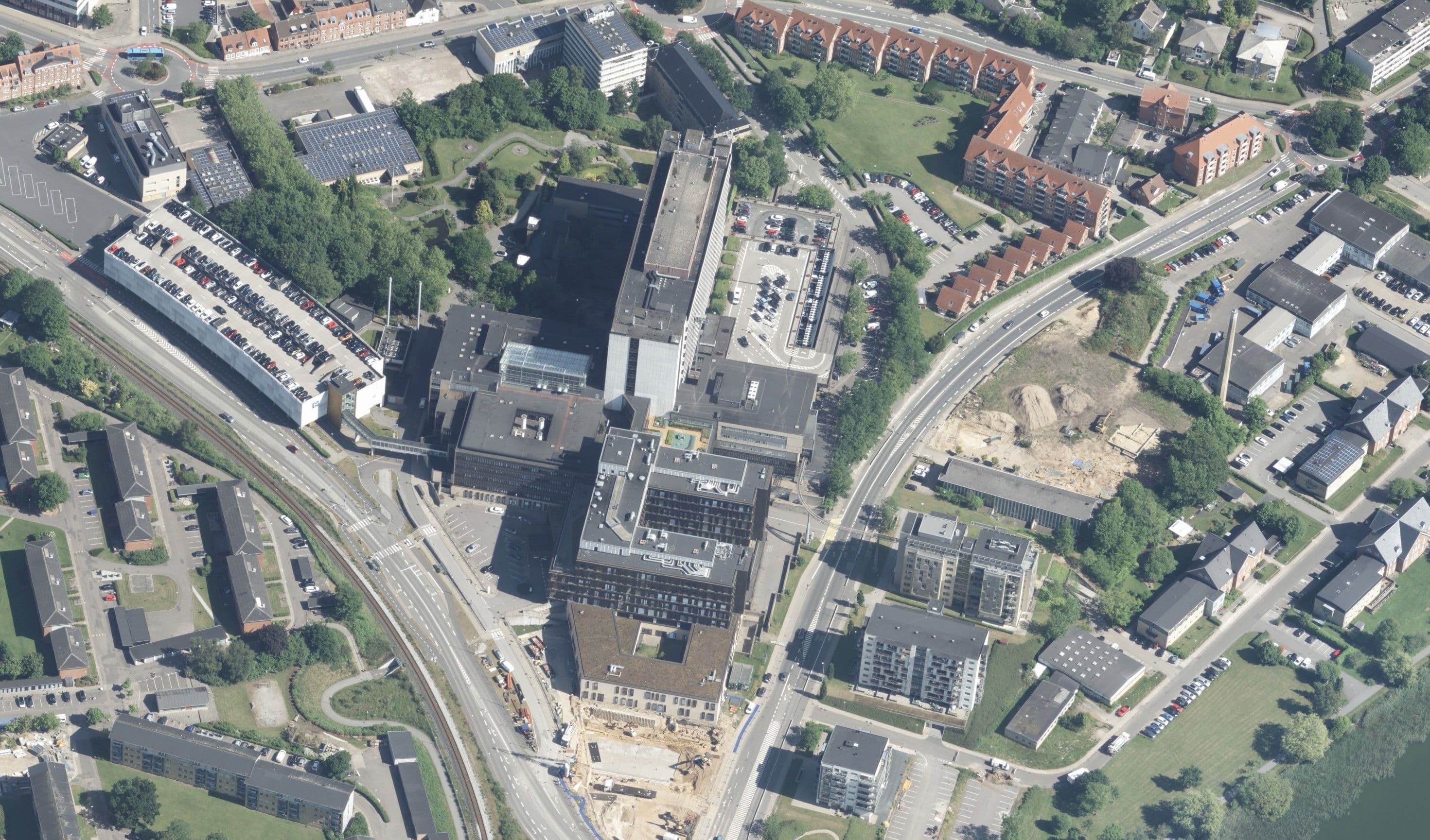
// Asset capture
Detailed as-built survey
As-built surveying creates transparency about the condition and surroundings of infrastructure and utility assets. Using digital aerial survey and airborne laser scanning (ALS) we capture power corridors, railway lines, pipelines and road corridors quickly, precisely and comprehensively. The high-accuracy 3D data forms the basis for planning, inspection, operation, maintenance and the construction of digital models. For high-accuracy results GSense relies on state-of-the-art sensors combined with specialized survey aircraft and helicopters. Through precise capture and complete documentation we create the basis for well-founded decisions and safeguard both sustainable operation and the long-term viability of the asset.
Georeferenced oblique imagery
Georeferenced oblique imagery delivers high-resolution views of infrastructure from multiple perspectives. Thanks to precise GNSS and IMU positioning it enables detailed condition assessments, reduces on-site inspections and forms a valuable basis for digital twins.
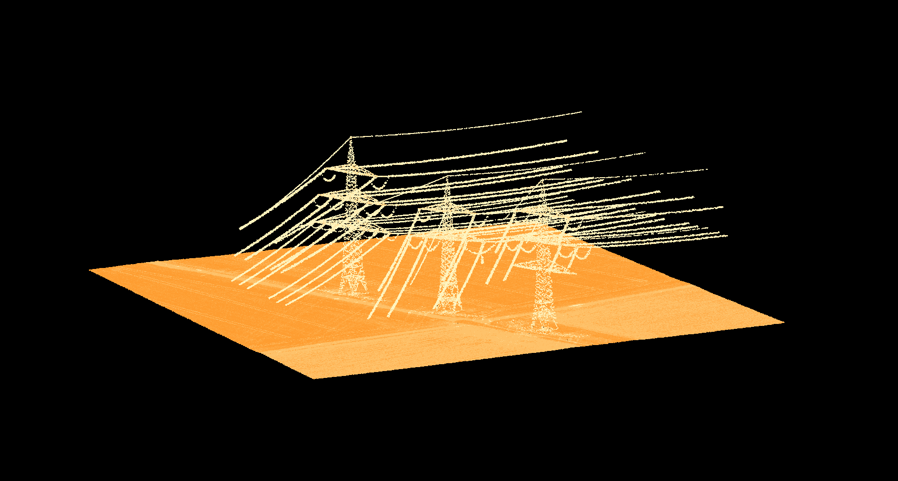
Corridor modeling
Precise corridor models based on laser scanning, photogrammetry and oblique imagery represent infrastructure true to life. They support analysis, planning and decisions across the entire lifecycle. The models integrate seamlessly into GIS systems and digital workflows.
// Monitoring & analysis
Intelligent monitoring & evaluation
Precise, continuous monitoring of energy and infrastructure assets is the basis for safe, economical and sustainable operation. Modern survey and analysis methods make it possible to capture, monitor and assess power corridors, railway lines and road corridors in detail. Potential risks can be identified early, safety clearances checked, vegetation monitored and planning baselines kept up to date. The resulting geospatial data supports network operators, infrastructure companies and planners in maintaining, documenting and future-proofing their assets.
Overhead lines & corridors
- Conductor sag analysis
- Object clearance analysis
- Ground clearance analysis
- Pylon analysis / pylon imagery
- Verification of safety clearances
- Tree fall analysis
Railway lines
- Position of catenary masts
- Cross-section and profile analyses
- Embankment and cutting geometry
- Tree fall analysis
- Verification of safety clearances
Road corridors
- Condition assessment of the road surface
- Monitoring of trees and vegetation along the road corridor
- Inventory and updating of as-built data
- Capture of cross-sections, shoulders and drainage structures
// Project coordination
Project management & coordination
GSense GmbH takes on the end-to-end coordination and management of your geospatial project and accompanies you through every project phase.
- 01
Concept
Drawing up a concept based on your specific project requirements.
- 02
Technology
Selecting the appropriate sensors and carrier platform.
- 03
Planning
Detailed flight and deployment planning.
- 04
Permits
Obtaining every permit required for the survey flight.
- 05
Execution
Operational management and execution of the data capture.
- 06
Processing
Evaluation and processing of the captured data.
- 07
Quality management
Quality assurance across the entire project cycle.